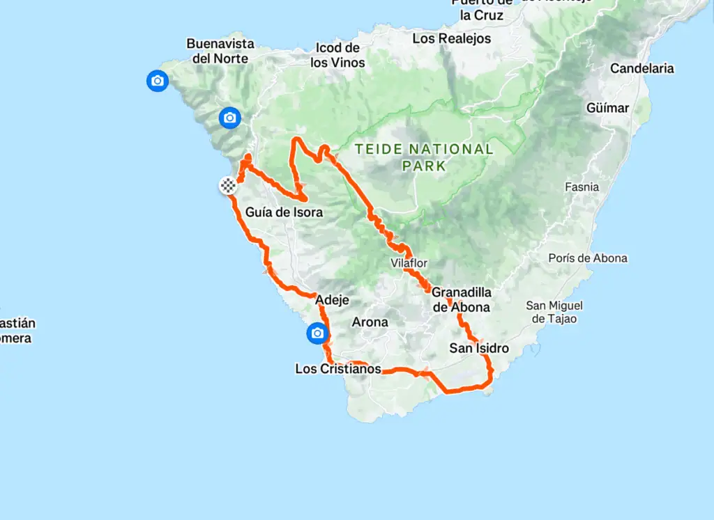
A legendary route through the volcanic heart of Tenerife. From sea to summit and back again, this ride captures the island's full drama — high altitude climbs, alpine moonscapes, lush valleys, and thrilling descents.
Check weather and wind before you go — especially on Teide above 2,000 m. Start early to avoid heat, traffic, and afternoon trade winds. Download the GPX below and charge your GPS or phone.
Ride planning
Puerto de Santiago
7-day forecast · Canary Islands
☀️
Today
29°
Today
☀️
29°
21°
💨18💧0%
Sun
☀️
32°
22°
💨14💧0%
Mon
☀️
34°
25°
💨14💧4%
Tue
☀️
36°
28°
💨14💧4%
Wed
☀️
38°
30°
💨15💧2%
Thu
🌤️
36°
27°
💨13💧2%
Fri
⛅
31°
25°
💨12💧0%
Forecast for Puerto de Santiago (coast). Mountain and Teide conditions can differ — check Windy or AEMET before long climbs.